The 4 Best Beginner-Friendly Rivers for Packrafting in New Zealand
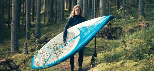
Best of all? They are lightweight enough to carry on your back if the water you’re searching for is a little further away.
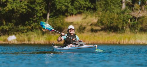
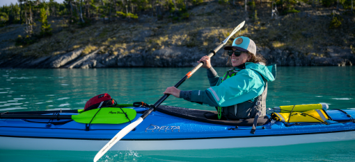
Learning a new sport can be either exhilarating or excruciating. Luckily, paddling a packraft is fairly forgiving for those with minimal paddling skills. The ability to fit your boat into a backpack makes the entire world accessible for packrafting, even for beginners.
During a recent trip to New Zealand in December 2017 and January 2018, we took our two Kokopelli Packrafts and Aqua-Bound Whiskey kayak paddles to the south island of New Zealand to try out a few rivers.
Starting and finishing in Queenstown, we found a huge variety of waters including peaceful lagoons that were wildlife refuges, and endless rivers for adrenaline-fueled descents down crashing rapids.
Here were the four best beginner friendly rivers for packrafting we found in New Zealand, as well as a bonus paddle for the bird lovers:
1. Rees River (Class I)
WHERE: Located in the Rees Valley, 68 km NW of Queenstown, this area is reached via the parking lot at Muddy Creek. While the road is accessible by 2WD after Glenorchy, it includes driving across fords and has some shallow creek crossings so a 4WD is preferred. 2WD would be difficult if there has been any heavy rain recently, and the road might technically not be permitted in most car rental agreements. Shuttles are available from Queenstown/Glenorchy.

WHAT: Starting at Muddy Creek, the hike is just under two hours to reach the swing bridge at 25 Mile Creek. Make sure you note where your pull out is—further downriver from Muddy Creek has Class III rapids.
The trail is flat, therefore easy to carry packs full of gear, which would make this a perfect trial to test your gear and fitness for carrying it.
Following a grassy valley floor with small boggy sections, the trail is incredible scenic. Glacially-capped mountains and undisturbed alpine tower on either side of the valley. The river itself is a vibrant blue that can have shallow sections if there has been little rainfall.
After reaching the swing bridge, set up the rafts and prepare for an easy float down river. The Rees depends on rain and melt levels, so it may not be high or fast during a dry spell in summer. In early 2018 there were no obstacles or rapids to worry about. Great for those who aren’t skilled at whitewater yet.
Don’t miss the awesome canyon at 25 Mile Creek just upstream of the swing bridge. It’s a short detour to a hidden waterfall in a deep canyon with amazingly blue water.
2. Dart River (Class I/II)
WHERE: Located on the adjacent valley to the Rees River and connected by a steep saddle hike or an hour’s drive via dirt roads, the parking lot for the Dart is 76 km NW of Queenstown. 2WD vehicles can manage the road to the parking lot at the Dart Track but rental car company likely won’t cover this area as fords and shallow creek crossings are necessary. Shuttle options are possible.

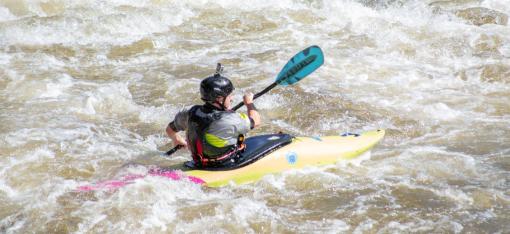
WHAT: Glacially fed, the Dart river runs faster than the Rees and has a larger volume of water. Similar terrain-wise with the Rees, the Dart carves its way through a deep valley with towering mountains and glacially capped peaks. With a handful of fun wave trains, some Class II rapids, and some flatwater explorations on a newly formed lake, the Dart has a great deal of variety.
Check out the pull out a hundred meters from the car park, then follow a mostly flat trail with some challenging sections for approximately seven hours to Daleys Flat Hut.
From here, you can decide to return to the car park right away, or opt to make it an overnight trip.
The hiking is slightly more challenging than the Department of Conservation guides explained. A new route built in 2017, detouring around an avalanche zone, requires you to climb over awkward footing and steep hillsides. In January 2018 this was manageable. If you are done with the sandflies by the time you arrive at the put in, there is a well-placed hut run by the DOC to crash in.
Mind the weather reports as wind can be brutal making rafting much slower or impossible. This is especially true while crossing the newly formed lake with a drowned forest. Also, learn where the jet boats go on the river. You’ll likely start encountering them half-way down. Don’t worry, you can definitely hear them coming and there is always an easy pull out spot.
There are few good sections of Class II rapids to test your paddling skills, but if they make you nervous, there are easy spots to get out of the water to walk around them. Regardless of your skill, keep an eye out for a section just below the lake rejoining the river. In 2018, it was fast moving with strainers—definitely a section to portage.
3. Haast River (Class I)
WHERE: Located in a World Heritage region on the West Coast of New Zealand, Pleasant Flat in the Haast Valley is 161 km from Queenstown over a winding but gorgeous road which passes through rainforests.
Along this route, one will pass a great deal of good looking rivers for a variety of skill levels. Keeping with the beginner theme, drive over the mountain passes beyond Pleasant Flat. From this point, the road follows the fast-flowing river that moves quickly but is graded mildly.
The best option is to park on the north end of the Haast Bridge and start hitchhiking if you don’t have a second car. A shuttle could probably be arranged in the village of Haast. Two places would make for a great put in for beginners: Roaring Billy Falls, about 30 km from the bridge, or Pleasant Flat Campsite which is about 50 km away.
At the Haast Bridge, there is an easy take out point used by commercial and private boaters just before the bridge itself on the north slope.

WHAT: Glacially fed from the beautiful Southern Alps which dwarf and enclose the valley, the Haast River is a striking emerald green river cutting through west coast rainforest. It begins in the mountains as a raging whitewater adventure in Haast Pass.
Nearly 100 km in length, the lower half of the river, from the grassy flats after Pleasant Flat, is a fast-flowing but easily navigated paddle. In normal conditions, from the put in at Roaring Billy Falls, it takes around four hours to the bridge take out.
In January of 2018 there were only a few dead trees in the river as obstacles, all easily avoided. But it would be wise to contact a local to ensure conditions remain navigable. A jet boat company operates in this river with a mobile office at the take out point. Providing them with a heads-up that you’ll be on the river is also advised and well received.
4. Hollyford River with or without Pyke Loop extension (Class I/II)
WHERE: The Hollyford is a sublime emerald green river in Fiordland National Park, about 272 km west of Queenstown. Emptying out in a bay just north of Milford, expect this region to be among New Zealand’s most scenic as well as wettest.
The start and finish on this one-way out and back trip or loop tour are located at the Hollyford Track and Hollyford road end. Only a small section of the road isn’t paved, but it’s well-maintained and accessible by all types of vehicles. Shuttles from Queenstown or nearby Te Anau are available.

WHAT: This should only be tackled by those with confidence in their paddling ability as well as those with a reasonably high level of fitness. Weather is probably the largest hazard and variable in this region. Due to its location on the west coast, rain can come fast and hard. Also, with several lake crossings on this route, wind can wreak havoc on your plans. Get up early in the day to avoid the wind and figure out the low tide timings for the coastal walking navigation.
Some guides will tell you how to do it in 10 days, this guide showcasing the trip in six days is probably a more reasonable option if you are doing the loop. Always make sure you are prepared for a few extra days in case of bad weather.
As of December 2017, the trek between the Hollyford and Pyke Rivers via Big Bay required two full days of hiking in sometimes less than favourable conditions.
If this doesn’t appeal to you, there’s an option to skip the Pyke loop and pay for a jet boat trip across Lake McKerrow back to the Hollyford track near Lake Alabaster. This would still require walking a full day to the road end. Another option is to splurge on a plane ride over to Milford Sound from Martins Bay Hut.
Book and enquire ahead of time if either of those options interest you.
Otherwise, the Pyke extension offers incredible views in a fairly remote area.
Small wave trains and Class II rapids make the Hollyford fun. Perfectly located huts help keep the sandflies at bay. It’s also a pretty popular track for packrafters, so a great place to learn where to go next.
If you’re going to do one multi-day packraft adventure in New Zealand, do this one.
Okarito Lagoon (Flat Water)
WHERE: Perfect for a half day of leisurely paddling, Okarito Lagoon is located 375 km north of Queenstown near the Franz Josef Glacier on the west coast.
Accessed via a paved road from 28 km Franz Josef, Okarito Lagoon is situated beside the boat house and parking lot amongst a town that was once New Zealand’s third largest port but is now a sleepy holiday home retreat.

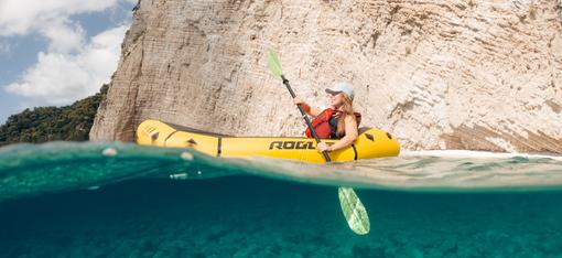
WHAT: As the largest unmodified estuarine wetland in New Zealand, this area is a beautiful location to paddle tidal flats and shallow open water amongst a backdrop of the Southern Alps.
Over 76 types of birds have been recorded here, and the area is home to an abundance of fish as well. With four rivers feeding the lagoon, all bordered by dense west coast rainforests, there are plenty of places to explore.
Local kayaking companies have set up pillars within the lagoon to follow as markers during low tide. Keep an eye out for those in order to find your way back out as well.
Rachel Bertsch (Kristensen) is a Canadian travel writer and international tour leader. She’s “outdoors obsessed and eternally curious” and loves sharing her adventures on her website, Meander the World. You can connect with Rachel on Instagram and Facebook, too.
More posts for you…