Packrafting Washington’s Methow River
6-minute read
In scenic northcentral Washington lies the Methow River, the “home river” of Aqua Bound Ambassador Jessica Kelley. Here she shares with us an expedition she’s been wanting to take for a long time—the Methow from start to finish.
by Jessica Kelley
The Methow River starts deep in the North Cascades, a tiny rivulet near Methow Pass. As it trickles down past jagged peaks and through clouds of mosquitoes, it’s labeled on maps as the West Fork Methow, although an East Fork does not appear to exist.
When it reaches the valley floor, it becomes the Methow River. It winds through Methow Valley, at times clogged with wood, at other times calm and placid. Still other times it’s full of big bouncy waves and Class III+ whitewater. The Methow River ends at the Columbia River, over 100 miles from its starting point.
After living near the river for several years and spending many hours paddling the more popular stretches, I decided I wanted to experience the entire Methow River from source to C(olumbia).
I liked the idea of watching the river change over time and space, much as it does through the seasons. In the same way that some folks summit peaks just to see what’s up there, I wanted to trace the river just to see what’s out there.
So, in the summer of 2022, I spent a little over three days following the Methow River from its source at Methow Pass, down to where it ends at the Columbia River in Pateros. I traveled by foot (27 miles), by bike (3 miles) and by boat (78 miles).

This map shows the sections she hiked (red), biked (green) and paddled (blue)
Here’s the story of my trip…
Day 0: Drop-off and Hike-in to Methow Pass
My husband Tom dropped me at the Rainy Pass trailhead at 6:30 on a warm summer evening. It had been brutally hot all day, so I was happy to see it was only 75F at the trailhead. I knew it would just get cooler from there as the sun set and I climbed into the alpine.
I saw a few through-hikers as I climbed up the Pacific Crest Trail, but once dusk settled in I found myself alone on the trail. I kept my headlamp off as long as possible, hiking up and over rocky mountain passes in the dim evening light, stopping occasionally to stare at the craggy peaks still faintly visible on the horizon.
I hiked quickly to keep the bugs at bay but still arrived at Methow Pass after dark. Setting up my tent under the Milky Way and two shooting stars, I soon fell asleep at the headwaters of the Methow River.
10.5 miles and 2,400 ft of elevation gain on foot

Jessica’s camp near the Methow’s headwaters, awakening to a gorgeous sunrise
Day 1: On-foot and On-bike
I woke up to a beautiful sunrise....and incredibly intense bugs (at least they weren't in tents? #momjokes). I improvised a head net with my hair and it actually worked!
After taking multiple photos of the sunrise, I crawled back into my tent for a short nap. At 9:00 I was awoken by the sun beating down on the tent walls, so I packed up quickly and started walking.

The Methow’s headwaters are high up in Washington’s North Cascade mountains
I got my first glimpse of the Baby Methow shortly thereafter—a tiny little creek tumbling down from the pass. I loved seeing where such a significant river starts its journey.

The beginning of the river
The day was characterized by heat, brush and bugs, but it was worth it to watch the Methow slowly grow from a rivulet to a river. The trail meandered through a recovering burn with no shade and multiple blow-downs. I trudged on, catching occasional glimpses of the river, which was too choked with burned logs to consider paddling just yet.
Eventually, I reached the end of the trail. A few minutes later Tom showed up with my bike and a cold drink. From here on out, he'd meet me each night in our truck camper. Luxury! I hopped on my bike and pedaled the final few miles toward camp, happy to be off my feet.
16.5 miles and 4,000 ft of descent on foot • 3 miles and 300 ft of descent on bike
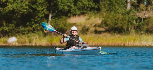
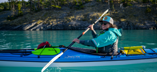
Day 2: The Paddling Begins
Time to start paddling! Sort of.
The upper Methow doesn't have any real rapids, but it does have lots of wood. Some folks call it "Class I with Class V consequences”!
The water was low enough that I felt comfortable doing this section alone, but I knew I still needed to be extra conservative. Low water slows things down, but any remaining current tends to push you right into strainers. This meant I was out of my boat every 5-10 minutes to portage around questionable logjams. Multiple gravel bars that were just a little too shallow to float required "walking the dog."
By Winthrop, there was less wood, more water and way more people—at least a dozen folks in tubes, rafts and SUPs. I was surprisingly happy for the company and found it energizing after a long day alone on the river—which was a strange feeling for this introvert.
I paddled steadily as the sun started to drop, and pulled into Twisp after almost 11 hours of boating, ready for dinner and some dry clothes.
33.5 miles and 750 ft of descent by boat

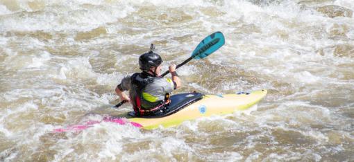
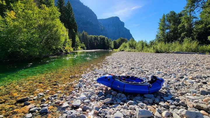
Day 3: Taking on the Canyon Section to the Columbia
My last day on the river! The first half of the day was mellow, as expected. I floated, paddled and then floated some more. I knew there were rapids waiting for me downstream, so I tried to enjoy the slower section for what it was.
I'd arranged to meet my friend Mikenzie just above the whitewater. As I neared our meeting point, I saw she was already on the water, eddied out and waiting for me!
Mikenzie had agreed to paddle the Black Canyon section with me (Class III-IV depending on water levels). I was grateful for her company and commitment.
Water levels were around 900 cfs (low), and several of the usual rapids were little more than a riffle. Black Canyon itself, though, was still churning, as was Staircase and a couple other features. Mikenzie is a very skilled boater. My tired brain and body were happy to follow her lines through the bigger rapids.
Before we knew it, the sun was setting, and we were approaching Pateros Lake. Never had it taken so long to paddle one mile.

Success at journey’s end!
Finally, the bridge separating the Methow from the Columbia came into view. Paddling under the bridge with a huge smile on my face, I was thrilled to have followed the Methow River from its source in the North Cascades all the way to where it ends at the Columbia River.
45 miles and 830 ft of descent by boat
I finished the trip sore, scraped up and wildly happy. It was an incredible journey and a great opportunity to become more familiar with the river valley I call home.

Thanks to Jessica for sharing her trip story with us! You can see more of her adventures on her Instagram page.
All photos courtesy of Jessica Kelley.
Do you have paddle questions our friendly Customer Service Team can help you with today? Contact them: 715-755-3405 • sales@aquabound.com
More for you...