Terrain360 and Its Benefit to Kayakers
12-minute read
Terrain360 is a web-based resource that showcases 360-degree virtual “tours” of natural resources like hiking trails and water trails. Its many applications include benefits for kayakers, canoeists and other paddlers.

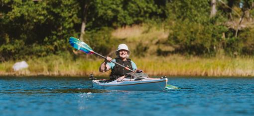
(Photo courtesy of Ben Fowler/PARKS360)
Think of it as Google Street View for nature—some have called it “Streamview.”
In an increasingly tech-savvy world, these kinds of digital resources are more used and valued than ever. One study found Millennials to be 130% more likely to choose a service or event if they can view a virtual tour first (reimaginemainstreet.com, 2021). It’s not hard to imagine successive generations continuing that trend.
Terrain360 is the first such digital resource to focus solely on providing 360-degree tours of the natural world. Owner Ryan Abrahamsen founded the company in 2012. As his work has progressed, he continually discovers new ways his ideas can be used for a surprising variety of clients.
Ryan and Ben Fowler (who joined the company in 2023 as Chief Research Officer) reached out to us to share the many benefits of their technology for kayakers, canoeists, paddleboards, kayak anglers and packrafters.
These benefits aren’t limited to the paddlers themselves but also to outfitters and guide services, parks, community organizations and natural resource managers. Advanced trip planning becomes easier. Access is more understandable. Parking, carry distance, shoreline—all are easy to see and plan around.
Ryan and Ben took time for a call recently. Here’s our interview with them:
AQUA BOUND: What was your motivation for starting Terrain360?
RYAN: Around 2012, I was literally just sitting on my couch looking at Google Street View (GSV). I thought, how cool would it be to have this for a hiking trail or a river? At the time, I was doing 360 imagery for a couple local college campuses. I wondered if there was a way to scale that up and do what GSV is doing.
Fast forward now, we figured out the tech and we’re doing it. The reasons have changed a little bit as 360 imagery is everywhere. We’re seeing asset managers use it to make decisions. Policymakers and agencies use it for education. Does this access site need repair? Do you want to scout a river before you go? The reasons why we do this are tenfold compared to when we started.
BEN: Google Street View really started coming out around 2007. It was only five years later that Ryan started to pursue how to expand on it. No one was taking 360 immersive imagery of natural resources, which is very different than traditional photography.
RYAN: The first real large-scale project was with the James River Association here in Virginia. As an advocacy group, they were very interested in us mapping out the entire 340 miles of the James. It took a whole summer! It was a major project and we barely knew what we were doing.
I had built a homemade cataraft that ended up being really useful for the project. We were able to mount cameras on it and travel down the river taking imagery. We had to figure out issues like powering the cameras and keeping the boat straight, but we did it. And the footage is used to this day by a lot of recreational paddlers.
Then the Chesapeake Conservancy found out what we were doing. They’re a larger organization overseeing the Chesapeake Bay area. They hired us to map all the rivers of the bay, a huge project. So now here we are doing what we’re doing.
Here’s a 30-second example of a video tour captured with 360 imagery:
AQUA BOUND: Does your finished project link to your website? Is it on your clients’ websites? Both?
RYAN: Both, it just depends on the client. Some have more recently integrated this into their virtual tours. Some have set up a web page where you can see the imagery and click into it. Some integrated it into their map platform. It just depends on what they want.
We did a project for the Bureau of Land Management in Montana. Their state office is using it for species and erosion analysis.
A paddling organization, a river keeper, a conservancy organization—some of them have more online resources than others. Our vision would be for our imagery to be on all those websites. It’s ideal for master planning for these rivers, developing water trails, things like that.
BEN: We’re always interested in the value the imagery serves. Some clients come to us with a very specific value. For example, a stormwater district in Cleveland wants to understand when the rain falls, how it goes into the ditches and then dumps into Lake Erie. They want to manage all of that. We took imagery every five feet and mapped their entire watershed, almost 500 miles with about 200,000 images.
We’ve developed different methods for capturing the imagery—drone, boat, backpack-mounted system. For resource managers, we always start with the problem. What problem are they trying to solve? How can this imagery help alleviate that? That’s the manager side of it.
The recreation side of it is where people use it as a resource to put on their website for marketing or planning a trip, doing risk management or scouting rapids. Outfitters and guides can also use it for these purposes.
AQUA BOUND: Are your locations always pretty accessible or do you also go into wilderness areas?
RYAN: We can go anywhere technically. The Everglades or the West is a good example of that because it’s very remote. In remote areas we’ll typically have the park service manager or BLM manager with us, so we have that access. We have an upcoming project on the Columbia River and will have one of the tribal people on the boat with us who’s involved with fishing there.
It really depends on the situation, but in most cases we have access. It’d be super cool to be in Canada or Alaska where we have to fly in sometime.

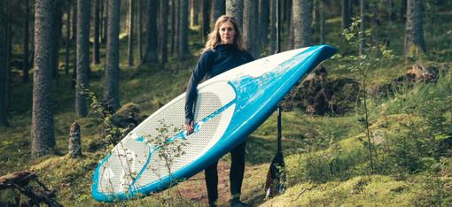
(Photo courtesy of Ben Fowler/PARKS360)
BEN: The wilderness question is interesting. I’m still finishing up my PhD at Clemson in Parks, Conservation and Outdoor Recreation Management and was getting into the research application of how this imagery can be used. For federally designated wilderness, there’s a debate. One, you’re not supposed to have mechanized equipment in protected, federally designated wilderness areas.
But that doesn’t mean you can’t take pictures. People in wilderness areas take pictures all the time. Obviously, you have to get permission to use a drone as that impacts visitor experience, wildlife, etc.
It’s our mission to capture as many parks, rivers and protected areas as we can so anybody can see them. There are areas, though, like tribal areas, where it’s a sensitive resource. There are areas where, unless you have permission or a really good reason for taking imagery, I don’t think every single place needs to necessarily be captured. Ryan and I wrestle with that sometimes.
RYAN: People have sometimes asked us why we’re taking an image of places that will make people want to go there. Well, in a lot of cases, a lot of people can’t get to these places. Those with a disability for example. They could immerse themselves in a place that would be difficult for them to get to. That’s one way of looking at it.
To Ben’s point, some areas are off-limits, like tribal areas. And even that depends on the tribe. But most public lands are open and accessible. At the same time, do we want people going there? It’s a question we do wrestle with.
AQUA BOUND: How do you decide which destinations you choose? Is it mainly client-driven or do you have time for your own choices?
RYAN: That’s a great question. 90% of our work is client-driven. They want us to capture their area. Then there are some cases where we’re going anyway so we’ll capture it while we’re there. For example, we have an upcoming project on the middle fork of the Salmon River. Because we have a permit we’re going to go ahead and capture it. It’s not a heavy expense if we’re already going to be there.
We have a lot of field workers so there are lots of logistics in planning a certain location. That’s where we rely mostly on client projects. January [the month of our interview] isn’t a big time of year for us going to map. So I want to find a project in an area that doesn’t cost a lot.
A couple years ago in the winter, we went down to Texas and did Big Bend National Park for a few days. Ben and I did the Altamaha River in February three years ago down in Georgia.
BEN: To add to what Ryan’s saying, largely it’s client-driven. But this is a passion for both of us. I was just using my 360 camera out in the snow on the beach from the recent winter storm. We’re always taking imagery.
When Ryan and I do projects together, we may see a river access site or trail that’s not on our specified project, but we’ll grab it anyway. We’re just genuinely passionate about capturing that, but it could end up being useful one day.
And there is something to say for the digital preservation of resources. Given everything we’re seeing with climate change, political decisions, areas that might be developed or used for different purposes—a digital record preserves that resource, in a sense, forever.
AQUA BOUND: Can readers suggest destinations?
RYAN: We get emails all the time asking if we have this or that on our website in their area. I have some analytics of what people are searching for on the website. A lot of these places are really obscure, like a small state park or county park.
BEN: We’re always thinking of how to make the website better for the viewers. How do we improve? How do we express the value of this to different clients?
In the next year or two we have ideas for several changes, but one of them is for interested viewers to submit an application for a resource they’re interested in. We’ve had ideas of using social media to hold some sort of contest where people can suggest certain areas. So we’re absolutely open to it. We just haven’t set up the logistics for it yet.

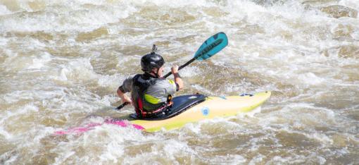
(Photo courtesy of Ben Fowler/PARKS360)
AQUA BOUND: Is any of your content crowdsourced currently, or could it be in the future?
RYAN: We use a certain type of camera, a DSLR with a larger lens that lets in more light. I’m into beautiful imagery, no matter where we are or what we’re doing. So I want to make sure the imagery is as good as we can get. You’re hitting the limits of physics with tiny cameras like those on phones.
BEN: Depending on the client, though, the beauty of the imagery isn’t necessarily a priority, as in the Ohio stormwater project.
The 360 camera industry is exploding. Anyone can go buy one, and the development of these consumer-grade cameras just keeps growing. We can’t be everywhere all the time, so one of our eventual ideas is to educate folks with these smaller, more consumer-available cameras.
Take a 200-mile stretch of river we captured previously and a certain area needs updated imagery. If we’ve educated management on how to use the equipment, our viewer and our software then they can take the imagery themselves and update their tour. I’m a big proponent of that eventually.
AQUA BOUND: Practically speaking, is your information set up to work equally well on a phone, tablet or computer screen?
RYAN: Absolutely. It’s a responsive display that’s designed to work on any device.
If there’s no [cell] service, that’s an issue for paddlers who may want to use it on the water. But that’s changing with technology and satellites. It’s better use is for pre-planning, but someone could certainly use it to see what it looks like 10 miles ahead or to find the access site.
BEN: I truly believe that in 5 or 10 years traditional imagery will be replaced with 360 imagery. We can’t articulate all the benefits quite yet, but it’s just objectively obvious. A better image gives a better experience. We hope to one day integrate with platforms like AllTrails and other apps and organizations where people are documenting their travels or planning their trips.
AQUA BOUND: Spell out for us the greatest benefits Terrain360 offers paddlers.
BEN: Access. Whoever you are, wherever you are, for whatever reason, it gives everyone equal virtual access to a place.
You can zoom into a specific location to understand the area. Depending on your skill level, you can plan ahead and prepare your trip, get acquainted with that resource. Access is such a big issue—understanding where you’re going to put in, where you’re going to take out, even where you’re going to park. Is there a restroom there? What amenities are available?
That information you can get before you go to enhance your trip. Terrain360 tells the story of these rivers and places in a way we’re not seeing anyone else do. Having that virtual experience is, I think, a benefit in itself.
To be completely honest, we’re still learning how to tell that story: what’s the benefit of this and how are people using it? As more people use it we’re constantly trying to be receptive to why and how. Is it water level? Is it signage? Little things like that can make a big difference.
And the benefits depend on what type of paddler you are, the resources you’re in, whether you’re the manager or a paddler. So it’s varied.

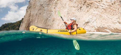
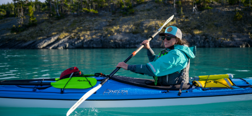
(Photo courtesy of Ben Fowler/PARKS360)
RYAN: I think trip planning is the number one thing. Plus I always go back to the folks who may never be able to visit some of these places for whatever reason. They can be inspired.
BEN: There are educational opportunities for a university teacher or an outdoor rec group. A club or organization can take members through the whole experience, and train people in trip planning or navigation.
* * * * *
We want to thank Ryan and Ben for their time! You can learn more about Terrain360 and see imagery of dozens of rivers around the US they’re already mapped on the website.
(All photos and video courtesy of Terrain360)
What paddling questions can our friendly Customer Service team help you with? Contact us at 715-755-3405 or sales@aquabound.com
More for you...